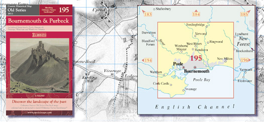
CASSINI MAP BOURNEMOUTH AND PURBECK (1811)
£9.99
incl. VAT, plus delivery
Not in stock
Delivery time: 1-2 day(s)Description
Explore the historic region of Bournemouth and Purbeck with the Cassini Map, based on the 1811 Ordnance Survey one-inch maps from the Old Series 195 collection. This beautifully detailed map has been meticulously re-scaled and re-projected to align with modern Ordnance Survey Landranger® standards, providing a scale of 1:50,000 for accurate navigation and exploration. Delve into the rich history and stunning landscapes of this picturesque area, whether you're a history enthusiast, outdoor adventurer, or simply looking to discover new places. The Cassini Map Bournemouth and Purbeck (1811) is the perfect companion for your next journey, offering a comprehensive and insightful guide to the beauty and charm of this timeless region.